 By st20113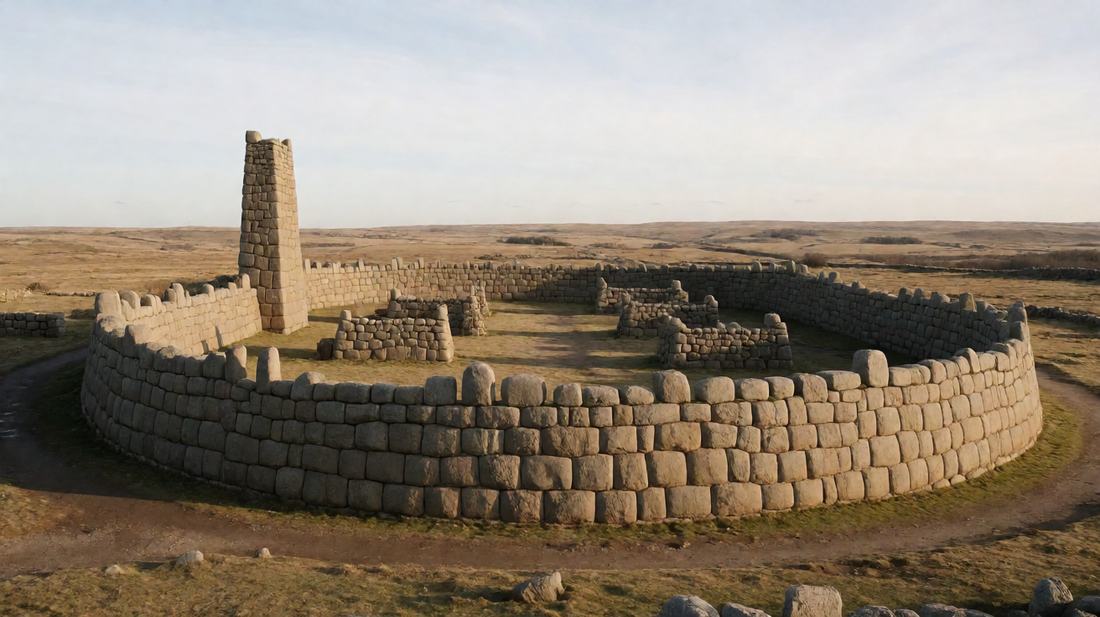
Great Zimbabwe | The City of Stone
Historical Profile · The Zimbabwe plateau, southern Africa
Great Zimbabwe | The City of Stone
A city of granite walls laid without mortar, built on the gold trade of the interior and long denied by those who could not accept who built it.
c. AD 1100-1450
Built
Walls
Great wall
City held
Listed
The big picture
Introduction
Stone ruins cover the plateau of south eastern Africa, in what is now Zimbabwe. Great Zimbabwe was the centre of a state that covered some 720 hectares. Between about AD 1100 and 1450, as many as 18000 people lived there. Granite blocks were laid on top of one another to make its walls, with no mortar in the joints. Nothing else of the kind in Africa south of the Sahara comes close in size.
Ruins on this scale raise an obvious question. For a long time the answer given was the wrong one. Shona ancestors built the city, in fact. Three groups of ruins still stand. The modern state takes its name from them.
Setting
Historical Context
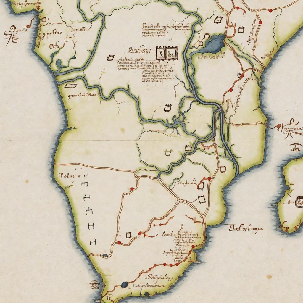
Two great rivers frame the plateau, and it had been settled for centuries before the walls went up. Its people spoke a language of the Shona group. They farmed the land and mined gold from shallow deposits. Because the interior had no coast, the region had to be tied into a long distance trade that ran to the sea. From the plateau, the rivers lead down to the lowlands of Mozambique.
From about AD 900, the ports at the far end of those routes joined a sea trade. In time, that trade reached Arabia, Persia, India and China. Gold from the plateau was what the traders wanted most. Therefore a settlement far inland came to depend on markets thousands of kilometres away.
Turning points
Key Events
People first lived at the site about AD 1100, in a village on the hill. Later walls on the plain came mostly in the 1200s and 1300s. Around the largest enclosure, the wall runs about 250 m. It rises to about 11 m, and at the base it is more than 5 m thick.
Finds from the site tell the story of its reach. Glass beads came from India, china from China, and metalwork from the coast. However, the population then began to fall away. By about 1450 the city was being abandoned, because trade had shifted north and east to other centres. Portuguese traders reached the interior in the 1500s. They found the great walls standing empty.
Yet local people never lost knowledge of the ruins. European travellers began writing about them in the 1800s. In 1891 the first organised excavation took place.
1
2
3
Who held power
People and Powers
Nothing was written down, so the story of its rulers has to be rebuilt from the buildings and the trade goods. What the archaeology shows is a society with a clear order. The hilltop site was both the oldest part and the most strongly walled. It is therefore usually read as the seat of the ruler.
On the plain, the great enclosure is more elaborate. Most scholars take it for a royal home or a meeting place rather than a fort. Power probably rested on control of the gold trade, however. It worked through a network of lesser chiefs across the plateau. Moreover, this state had no army of the kind found on the coast. Instead its authority depended on the wealth it could give out. The standing of its leading families mattered too. Society divided between the ruling families, the craftsmen who built the walls, and the farmers who fed the whole.
Everyday world
Daily Life and Society
Most of the city’s people did not live inside the great walls. They lived in clusters of houses built of earth and poles. Only a few worked the stone. Ordinary houses were round, with a plastered floor. Each cluster also had its own space for cooking, storage and work.
People farmed the land nearby and mined gold in season. Iron and copper were worked there too. Cloth, pottery and metal tools were made both for local use and for trade. Goods arriving from outside therefore show how far daily life reached. Beads of glass and stone, bowls from China and dishes from Persia ended up in the homes of the better off. Because routes carried gold down to the coast, the whole settlement was tied to that traffic.
Craft and ideas
Trade, Technology and Ideas
The building is the great achievement. Walls are made of granite blocks split from natural outcrops. Because they were laid without mortar, in courses that curve to follow the shape of each wall. A slight lean inward was given to the walls as they rise. That is why they have stood for 600 years.
The trade system behind the city was of a type seen across Africa in the same period. A state holding the middle of a route, and taxing what passed along it, could grow rich. Great Zimbabwe held the inland end of the gold route. Likewise, the states of the western Sudan held the middle of the routes across the desert.
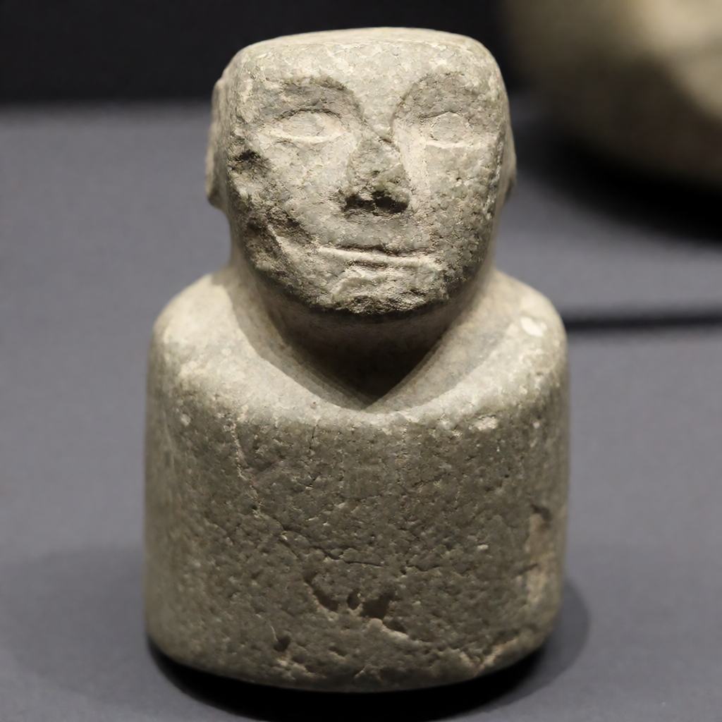
Although the two regions belonged to the same pattern, their trade ran to opposite coasts. Great Zimbabwe and the Mali Empire were never in contact. Stone and metal were worked here to a high standard too. Carved figures were cut from soft stone with great care, each set on a tall pillar.
What lasted
Legacy
In 1986, Great Zimbabwe was listed as a world heritage site. Its ruins still stand as the country’s main monument. A carved stone figure from the site appears on the national flag. This place also carries a darker history.
When Europeans first studied the walls, the accepted view was that African people could not have built them. Indeed, a great deal of effort went into explaining them as the work of strangers. Although the evidence against that view was clear by the 1920s, the argument was kept going for reasons of state. For decades work at the site was twisted to fit. Only after independence could the work be done freely. Great Zimbabwe is now read as the centre of a large and ordered African state.
Common misreadings
What People Get Wrong
Three claims about Great Zimbabwe circulate widely, and all three fail against the evidence.
- Outsiders must have built the walls. This was the accepted view among European scholars until the 1920s, when excavations showed the stonework to be continuous with local Shona building traditions. The claim was kept alive afterwards for reasons of state, not archaeological ones.
- The name means “great stone houses” and nothing more. In fact zimbabwe is a Shona term for a venerated court or royal home. The name thus describes what the place was used for, not just what it was built from.
- Great Zimbabwe traded directly with China. No direct contact is recorded. Goods reached the plateau through the Swahili ports of the Mozambique coast. They passed through several hands before they arrived.
Side by side
Great Zimbabwe and Mali Compared
Both were African states that grew rich by taxing trade, yet their positions in the network could hardly have been more different.
| Great Zimbabwe | Mali Empire | |
|---|---|---|
| Peak period | c. AD 1100–1450 | c. AD 1235–1600 |
| Position on the route | Inland end of the gold route | Middle of the desert routes |
| Trade outlet | Indian Ocean ports | Sahara crossing to North Africa |
| Main export | Gold | Gold and salt |
| Building material | Dry stone granite | Earth and timber |
| Direct contact | None recorded between the two | |
Sources
Sources and Further Reading
- UNESCO World Heritage Centre, “Great Zimbabwe National Monument” — whc.unesco.org/en/list/364
- Pikirayi, I., The Zimbabwe Culture: Origins and Decline of Southern Zambezian States (AltaMira, 2001)
- Garlake, P., Great Zimbabwe (Thames & Hudson, 1973)
- Beach, D. N., The Shona and Zimbabwe 900–1850 (Heinemann, 1980)
Quick hits
Five Things to Remember
- Great Zimbabwe was built between about AD 1100 and 1450.
- Its walls are made of granite blocks laid without mortar, and they are the largest of their kind south of the Sahara.
- The city grew rich on the gold trade that ran down to the ports of the Indian Ocean coast.
- It covered some 720 hectares and held up to 18000 people at its height.
- It became a world heritage site in 1986 and gave its name to the modern state.